

1
Feature Story
New research harnesses AI and satellite imagery to reveal the expanding footprint of human activity at sea
Jan 04, 2024 · globalfishingwatch.org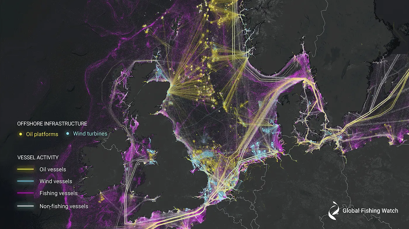
The study found numerous "dark fleets" or vessels not broadcasting their positions, posing challenges for natural resource protection and management. It also revealed that Asia dominates global fishing activity, contrary to publicly available data suggesting similar levels of fishing in Asia and Europe. The study also noted changes in human activity in the ocean, including a global drop in fishing activity by about 12% during the COVID-19 pandemic, stable transport and energy vessel activity, and a surge in offshore energy development. The researchers believe this technology can help tackle climate change by improving estimates of greenhouse gas emissions at sea and informing wind development or tracking marine degradation caused by oil exploration.
Key takeaways
- A new study by Global Fishing Watch has used machine learning and satellite imagery to create the first global map of large vessel traffic and offshore infrastructure, revealing that 75% of the world’s industrial fishing vessels are hidden from public view.
- The study analyzed 2 million gigabytes of satellite imagery from 2017-2021, identifying vessels that failed to broadcast their positions and concluding which of these were likely engaged in fishing activity.
- The research found numerous "dark fleets" inside many marine protected areas and a high concentration of vessels in many countries’ waters that previously showed little-to-no vessel activity by public monitoring systems.
- The study also highlighted the changing nature of human activity in the ocean, with a global drop in fishing activity during the COVID-19 pandemic, a surge in offshore energy development, and the potential of the new technology to improve estimates of greenhouse gas emissions at sea.