

1
Feature Story
Satellite imagery analysis shows immense scale of dark fishing industry | TechCrunch
Jan 04, 2024 · techcrunch.com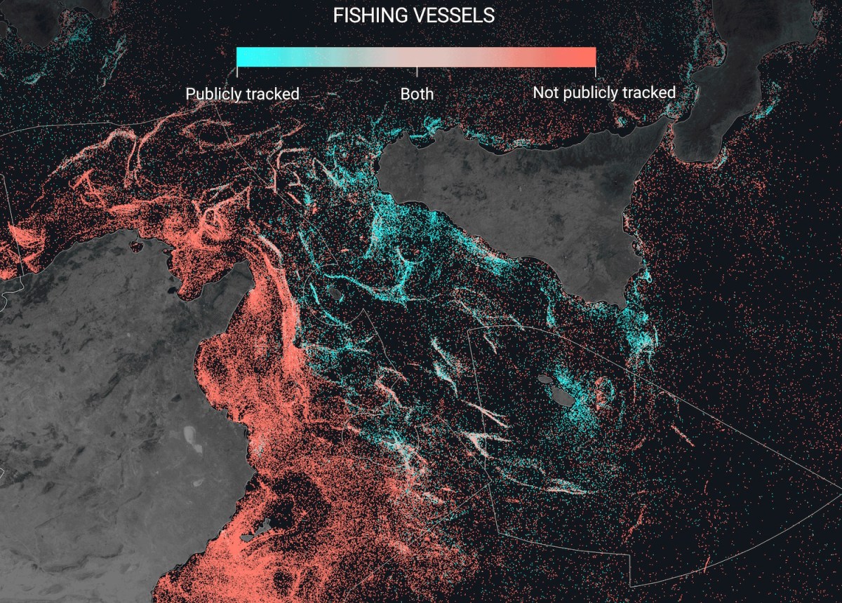
The study's findings highlight the need for improved tracking and data sharing of vessel activity to better manage fish stocks and protect marine environments. The researchers hope that the improved data will guide policy decisions and are working with authorities to assess the new maps. They are also processing new radar imagery from the Sentinel-1 satellite to identify activity across the globe, with the data available on their open data platform.
Key takeaways
- Around three-fourths of all industrial fishing vessels and almost a third of all transport and energy vessels are not publicly tracked, according to a study by Global Fishing Watch.
- Satellite imagery and machine learning are being used to track these vessels, offering a more accurate picture of the maritime industry than previously available data.
- The study found that the Asian fishing industry is systematically under-represented, with satellite data showing 71% of fishing vessels are in Asian waters, contradicting AIS data.
- Improved data from satellite imagery and machine learning can help guide policy and monitor illegal fishing in protected areas.